Admission into the course is open to all but requires instructor approval. To be considered for admission, please send:
Send these to ace[at]aua.am by June 23, 2017. Place “Applying for Urban Environmental Mapping Course” in the subject headline.
If you have any questions, please contact +374-60-61-2520 during regular business hours (9:00-18:00 Yerevan time) or write to ace[at]aua.am.
For tuition related questions, AUA and NUACA students should contact their respective Registrar Offices.
For those who apply and are selected (see “How to Apply” section above) but are not current AUA or NUACA students, the tuition is 165,000 AMD. Selected applicants will be contacted about the registration and payment details.
AUA Subject Code: ENV 215/325
AUA Number of Credits: 3
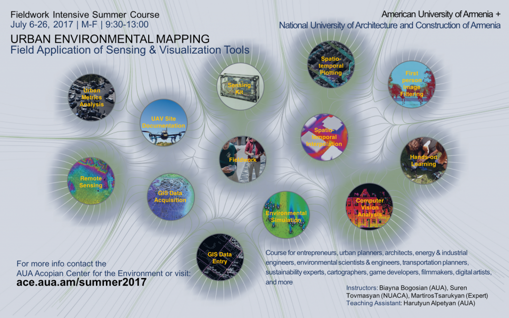
Instructors: Biayna Bogosian (AUA), Suren Tovmasyan (NUACA), Martiros Tsarukyan (Expert)
Teaching Assistant: Harutyun Alpetyan (AUA)
Term/Year: Summer 2017 Lecture/Lab/Field July 6-26 and final presentation on July 31
Class Schedule: MTWRF, 9:30am-1:00pm
Language of Instruction: English
Prerequisites: Sufficient knowledge of English and instructor approval
Co-Requisites: None
This course focuses on spatio-temporal mapping of urban environments, with emphasis on field application of sensors and visualization technologies. Participants will be introduced to the theoretical and technical framework of urban environmental data acquisition and visualization using readily available sensing kits and the state-of-the-art mapping platforms. This course promotes active student participation and intensive fieldwork. Students will become familiar and apply the following mapping, visualization, and physical computing platforms: ArcGIS or QGIS (open-source) for mapping, Rhino3D and its plug-in Grasshopper for data processing and visualization, and Arduino software/hardware for physical computing and environmental data acquisition. This course will culminate in composition and presentation of a 5-minute videos that will document the students’ workflows and findings.
With the advent of ubiquitous computing, sensor networking and information processing technologies, we are generating and recording unprecedented quantities of data related to ourselves and the environment. Geographic Information Systems (GIS) and Geographic Positioning Systems (GPS) are becoming more advanced and integrated into our daily behaviors, allowing for high-resolution and accurate geographical analysis and visualizations that communicate with both the scientists and the citizens. So, how can we utilize existing databases to better understand our cities and their relationship to environmental parameters? What are the appropriate analysis and visualization methods for these complex databases? What if we do not have access to these urban databases? Can we acquire the data ourselves? What type of tools would we need? Can we crowdsource the process to engage with the experts, as well as with the citizen scientists? What are the advantages and disadvantages of incorporating data collected by the public that might not have the same accuracy as the ones collected by the experts? How can we integrate existing databases with the data we collect? This course will address these questions through series of lectures, readings, hands-on exercises, as well as intensive fieldwork.
In order to better understand urban issues such as, air pollution, transportation, biodiversity, and the relationship between water use and land use, it is necessary to identify existing data sources and collection methods. It is also important to explore alternative means of capturing urban metrics at a finer spatial resolution which would enable us to meaningfully integrate these various layers of data for problem solving. Thus, this course will introduce the theoretical and technical framework of urban data acquisition, visualization, and analysis, with the use of modern geodetic equipment, as well as readily available sensing kits which students will learn to assembly and apply throughout the course.
The working methodology advocated here promotes active participation of the students in mapping and understanding our complex urban fabric and the relationship to environmental issues. This course also emphasizes the importance of spatial resolution for urban analysis and takes advantage of accessibility to sensors and mobile devices for constructing new databases. This method would not only provide finer grain data for the expert communities, but through comprehensive visualizations and analysis, would also elevate the public’s environmental consciousness and literacy. The goal is to amplify the reading of our urban and environmental data for the formulation of locally informed policies in order to increase sensitivity towards the built environment and its interactions with the natural environment.
GIS documentation + Analysis: Esri ArcGIS + QGIS (open-source)
Spatial Visualization + analysis: Rhino3D, Grasshopper3D
Sensing software: Arduino Program + Grasshopper plug-in for Arduino I/O
Sensing hardware: Arduino Microcontroller, GPS shield, various sensors such as, temperature, humidity, PM10+2.5, CO, CO2, NO2, sound, light, image.
Drawing + diagram construction: Adobe Photoshop + Illustrator
Editing + Post Production: Adobe After Effects
All readings will be added to the course Moodle page. Readings are critical to your understanding of course concepts, in-class discussions, and execution of the projects.
Class time will be broken down into four main parts: Lecture, discussion, in-class exercises, and fieldwork. Homework will be varied daily due to the compact nature of the course.
| Percentage | Assessment |
| 10 | Individual Participation |
| 15 | Individual Software Tutorials |
| 15 | Group Project Phase 1 |
| 15 | Group Project Phase 2 |
| 20 | Group Project Phase 3 |
| 25 | Group Project Phase 4 |
Participation | 10%: Students are expected to attend class and demonstrate their understanding of topics by participating in class discussions. Attendance may be taken at any class. Students who miss more than three classes will have 2 points deducted from their class participation grade (total 10 points). Students who arrive more than 5 minutes late will be marked as absent.
Software Tutorials | 15%: These software tutorials will be assigned throughout the first half of the course to reinforce concepts and skills.
Group Project | 75%: Students will form groups of two or three to formulate and execute an urban environmental mapping project.
Phase 1: Selecting relevant metrics for project objectives | 15%
Each group will select an urban metric to investigate using methods introduced in the first week. Students will identify potential sites suitable for their specific project objectives and utilize existing GIS data and Remote Sensing techniques map potential data acquisition trajectories.
Deliverables: Workflow diagram, GIS site documentation in Rhino/Grasshopper, Remote Sensing site documentation in ArcGIS
Due: Please upload your submission to the course Moodle by 9:00am on July 12th
Phase 2: On-site data acquisition using custom sensing kits | 15%
Students will assemble sensing kits custom for their specific metrics, and begin testing the sensing assembly in designated areas. Depending on the scale of the projects, students will walk, bike or fly UAVs during data collection. After each collection, students will plot the data to not only ensure sensing kit calibration, but also study data patterns and their relationship to the urban fabric and environmental parameters.
Deliverables: Revised workflow diagram, Rhino3D/Grasshopper visualization of the data
Due: Please upload your submission to the course Moodle by 9:00am on July 18th
Phase 3: Database construction and analysis | 20%
Students will complete their on-site data acquisition and convert the data into GIS compatible formats. Students will also study data collected by others and, if trusted, incorporate them into their mapping and analysis.
Deliverables: Revised workflow diagram, GIS database shared with the class.
Due: Please upload your submission to the course Moodle by 9:00am on July 21th
Phase 4: Spatio-temporal visualization | 25%
Students will apply spatio-temporal visualization and analysis techniques in ArcGIS and Rhino/Grasshopper, and will produce series of animations that captures their workflow and analysis. Students will be introduced to static and dynamic documentation platforms to compile a comprehensive 5-minute video documentations of their research.
Deliverables: Revised workflow diagram, 5-minute video documentation
Draft Due: Please upload your submission to the course Moodle by 9:00am on July 26th
Exhibition Content Due: TBD
Grading scale used:
| Highest Lowest Letter |
| 100.00 % 97.00 % A+ |
| 96.99 % 94.00 % A |
| 93.99 % 90.00 % A- |
| 89.99 % 87.00 % B+ |
| 86.99 % 84.00 % B |
| 83.99 % 80.00 % B- |
| 79.99 % 77.00 % C+ |
| 76.99 % 74.00 % C |
| 73.99 % 70.00 % C- |
| 69.99 % 67.00 % D+ |
| 66.99 % 64.00 % D |
| 63.99 % 60.00 % D- |
| 59.99 % 00.00 % F |
Students are encouraged to use supplemental online and reference materials available at the library to enhance their overall learning in the course. Students are encouraged to use audio-visual aids and presentation software as appropriate. The use of all such supplemental materials shall be subject to standards of academic integrity discussed below.
All supplemental material used is subject to Standards of Academic Integrity discussed below.
If students have any questions or need additional support in using library resources or technology, they should confer with library staff, ICT, or the instructor.
A half grade will be deducted from an assignment each day that it late (e.g. an assignment graded as an A will become a B+ if it is submitted two days late). The instructor might not penalize the student if the student submits convincing evidence of a medical or other emergency that made completing the assignment at the scheduled time impossible.
No makeup of assignments, exams, and quizzes will be given unless students submit convincing evidence of a medical or other emergency that makes completing an assignment or taking an exam or quiz at the scheduled time impossible.
Students are entitled to appeal grades in line with the university’s grade appeal policy which is available online at http://aua.am/policies
Students are required to conduct themselves in an academically responsible and ethical manner in line with the Student Code of Ethics. Acts of academic dishonesty impair the academic integrity of AUA and create an unfair academic advantage for the student involved and other member(s) of the academic community. These acts are subject to disciplinary measures as prescribed in the AUA Code of Student Ethics: http://aua.am/wp-content/uploads/2012/02/stud_code_ethics.pdf
Students requiring special accommodations for learning should contact the Student Services Coordinator by end of Drop/Add period with such requests. See http://studentsuccess.aua.am/disability/.
Unless course instructors state otherwise, students are expected to bring mobile communication devices (smart phones, tablets, laptops) to the classroom for every session in order to access the AUA Moodle and other sites as instructed by the course instructor. If a student does not have any such device, s/he should contact the course instructor(s) so that arrangements can be made to have a device available in class for her/his use. During class, these devices are to be used only for purposes specified by the instructor. Violation of this rule may result in the dismissal of the student.
All students enrolled in class must immediately enroll in the Moodle site for the course. The enrollment key will be provided in class. Failure to do this may result in loss of grades as some, if not all, quizzes, exams, and assignments will be delivered or accepted only on Moodle. Without enrolling in the Moodle site, you will not be able to take quizzes and exams or turn in assignments.